Don Harmon: Selected Photographs 1958 - 1985

Don Harmon, 1976, Athabasca Glacier Flowing From Columbia
Icefield. || Headwater of Athabasca River, this glacier is the most publicly visible of Columbia Icefield’s glaciers. It may be seen from the ice field Parkway and its recession has been documented for years. A tourist once sued Parks Canada after he fell in a crevasse on Athabasca Glacier.
> PURCHASE INFORMATION

Don Harmon, 1969, Mt. Assiniboine, Wedgewood Peak and Mt.
Strom, with Sunburst Lake in the foreground. || Sometimes called the "Matterhorn of the Rockies". Mt. Assiniboine Lodge in Mt. Assiniboine Provincial Park is a popular hiking and skiing destination.
> PURCHASE INFORMATION

Don Harmon, 1969, Mt. Cory from Cory Pass
|| Mt. Cory is one of the most popular climbs near Banff. The mountain was named in 1923 after William Wallace Cory, deputy minister of the Interior from 1905 to 1930.
> PURCHASE INFORMATION

Don Harmon, 1960's, Ice Bridge on Opabin Glacier || Ice formations as dramatic as this one are transient. Opabin Glacier drapes the pass between Lake O’Hara and Prospectors Valley.
> PURCHASE INFORMATION

Don Harmon, 1972, Mt. Ball and Haiduk Lake from Whistling Pass, Banff National Park. || Whistling Pass is named for the whistling marmots, a rodent whose home this is.
> PURCHASE INFORMATION

Don Harmon, 1977, Aerial view of Columbia Icefield || The tumultuous descent from the apex of Snow Dome causes the snow and ice to crack in great crevasses.
> PURCHASE INFORMATION

Don Harmon, 1976, Ice Detail, Columbia Icefield || This photograph was taken in a large ice cave on Athabasca Glacier which lasted several years before melting and collapsing.
> PURCHASE INFORMATION

Don Harmon, 1979, Ice Cave Detail, Athabasca Glacier || The ice in caves and crevasses of glaciers always appears this gorgeous turquoise.
> PURCHASE INFORMATION

Don Harmon, 1975, Peyto Lake and Mistaya Valley || This lovely view looks north from Bow Summit on the Icefield Parkway. The lake is named for legendary pioneer, hunter, trapper and guide, Bill Peyto.
> PURCHASE INFORMATION

Don Harmon, 1985, Canoe on Maligne Lake, Jasper National Park || Canoe rentals and a launch which tours the lake allow visitors to explore one of the largest lakes in the Canadian Rockies.
> PURCHASE INFORMATION
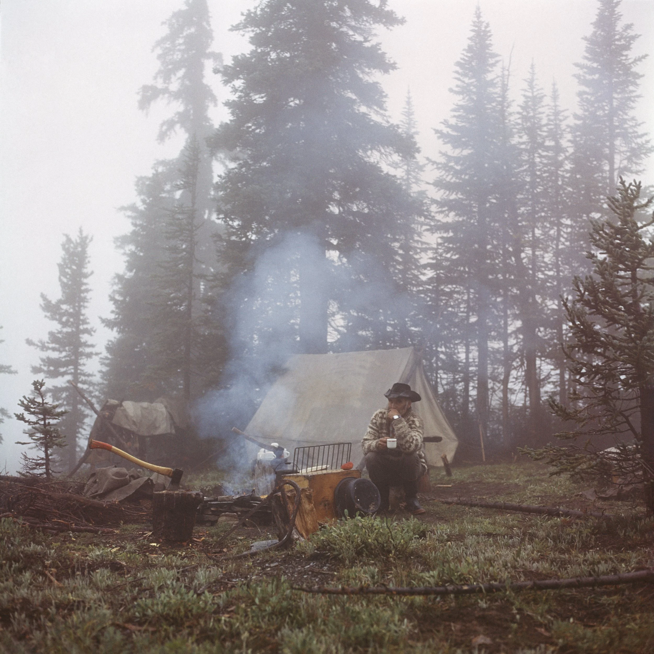
Don Harmon, 1975, Bert Mickle in Castleguard Meadows || Outfitter Bert Mickle, with his wife, June, ran Timberline Tours near Lake Louise from 1962-1974.
> PURCHASE INFORMATION

Don Harmon, 1983, Dawn at Bow Lake || My father woke me at 2:30 AM to drive with him to Bow Lake for first light.
> PURCHASE INFORMATION

Don Harmon, 1979, Columbia Glacier and Mt. Columbia || Confusingly, this is the headwater of the great Athabasca River system which flows north to the Arctic Ocean. It was photographic goal for both Byron and Don Harmon.
> PURCHASE INFORMATION

Don Harmon, 1975, Alexandra Glacier, source of Alexandra River || Alexandra River is a tributary of The North Saskatchewan River, Banff National Park.
> PURCHASE INFORMATION
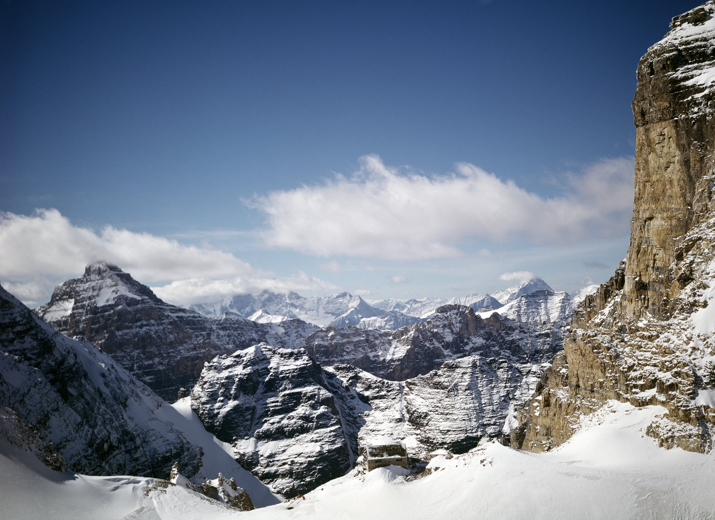
Don Harmon, 1970's, Abbot Pass and Abbot Hut from the Air || In 1922 Abbot Hut was built by Swiss guides, from locally quarried stone, on the pass between Lake Louise and Lake O’Hara. It accommodated climbers for a century before climate warming caused the hut to be removed by Parks Canada.
> PURCHASE INFORMATION

Don Harmon, View from Wiwaxy Col, Lake O'Hara || Lake O’Hara, in Yoho National Park, is unique in the Canadian Rockies for its extensive trail system developed by volunteers of the Lake O’Hara Trails Club, Carson Simpson and George Link, who built the trails at Lake O'Hara between 1943 and 1951. Warden Lawrence Grassi further improved and developed these trails while stationed at the Lake O’Hara warden cabin.
> PURCHASE INFORMATION

Don Harmon, 1975, Carole Harmon in Castleguard Cave || Castleguard Cave is one of several outlets for a vast under-glacier karst system which collects meltwaters from Columbia Icefield.
> PURCHASE INFORMATION

Don Harmon, 1978, Tangle Falls on Sunwapta River || Now easy to see from the Icefield Parkway in the Canadian Rockies, Tangle Falls was once protected from view by torturous Sunwapta Canyon which was avoided by travellers before the highway was built.
> PURCHASE INFORMATION

Don Harmon, 1972, Tom Wilson's Cabin, Kootenay Plains || Kootenay Plains is traditional land of several Indigenous nations who still visit there and hold ceremony in this area. When Bighorn Dam was built, in 1972, my father and I photographed Tom Wilson’s old ranch on Kootenay Plains, which would soon be flooded by the dam, along with the rest of this fertile and culturally significant land, which had been a major trade route through the mountains.
> PURCHASE INFORMATION

Don Harmon, 1969, Moraine Lake, Banff National Park || Moraine Lake is located in The Valley of the Ten Peaks, near Lake Louise. The peaks were named by Samuel Allen, an early white visitor to the lake, for the Stoney Nakoda numbers one to ten.
> PURCHASE INFORMATION
